 |
Columbus RiverWalk(Trail near Chattahoochee River Whitewater) |
|
Alternate Name(s): Chattahoochee RiverWalk
Website: Facebook.com/Columbus.RiverWalk
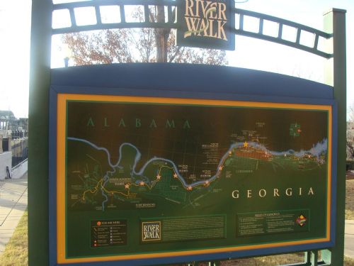
DescriptionHistory The second phase of the RiverWalk extended it from the Columbus Convention and Trade Center in Downtown to Oxbow Meadows in South Columbus. Before expanding the North end of the RiverWalk, the city extended the path to the Infantry Center at Fort Benning. The stretch from theTSYS building to the Bibb Mill was constructed in the third phase. The fourth phase extended the RiverWalk from the Bibb Mill to the Lake Oliver Dam. Construction began in 2009 to connect the RiverWalk from the 14th Street bridge to the Eagle Phenix Mill Dam. This section opened in early 2011. The RiverWalk begins in North Columbus at Lake Oliver and extends southward twenty-two miles to Fort Benning, Ga.
ID: 6998DCD5-68FA-455C-A6E4-96CC63E69BF9 6998DCD5-68FA-455C-A6E4-96CC63E69BF9
|
|
Quick Links Chattahoochee River Whitewater News Chattahoochee River Whitewater Photos Chattahoochee River Whitewater Videos |

 Login
Login


